![]()
| Home Michael Ammar Solar System Solar System Summary Sun Sun's Statistics Mercury Mercury's Statistics Venus Venus' Statistics Earth Earth's Statistics Mars Mars' Statistics Asteroid Field Asteroid Field's Statistics Jupiter Jupiter's Statistics Saturn Saturn's Statistics Uranus Uranus' Statistics Neptun Neptun's Statistics Pluto Pluto's Statistics Picture Library |
|
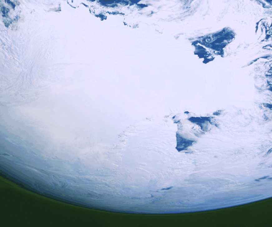
| Antarctica This image of Antarctica was taken by Galileo several hours after it flew close to the Earth on December 8, 1990. This is the first picture of the whole Antarctic continent taken nearly at once from space. Galileo was about 200,000 kilometers (125,000 miles) from Earth when the pictures were taken. The icy continent is surrounded by the dark blue of three oceans: the Pacific to the right, the Indian to the top, and a piece of the Atlantic to the lower left. Nearly the entire continent was sunlit at this time of year, just two weeks before southern summer solstice. The arc of dark spots extending from near the South Pole (close to the center) toward the upper right is the Transantarctic Mountain Range. To the right of the mountains is the vast Ross Ice Shelf and the shelf's sharp border with the dark waters of the Ross Sea. The thin blue line along the Earth's limb marks our planet's atmosphere. (Courtesy Calvin J. Hamilton) |
Send mail to [email protected] with questions or comments
about this web site.
Copyright � 1998 Michael Ammar.