![]()
| Home Michael Ammar Solar System Solar System Summary Sun Sun's Statistics Mercury Mercury's Statistics Venus Venus' Statistics Earth Earth's Statistics Mars Mars' Statistics Asteroid Field Asteroid Field's Statistics Jupiter Jupiter's Statistics Saturn Saturn's Statistics Uranus Uranus' Statistics Neptun Neptun's Statistics Pluto Pluto's Statistics Picture Library |
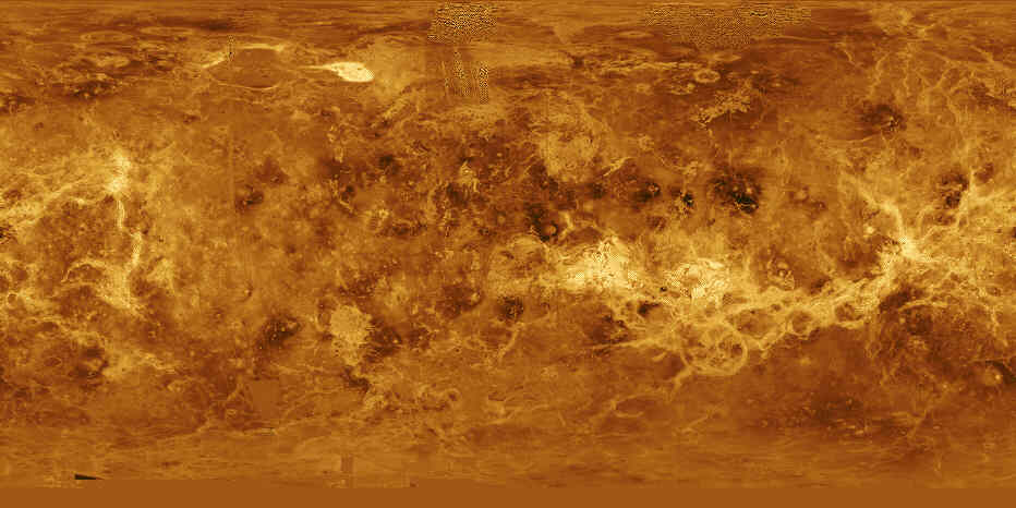 |
| Cylindrical Map
of Venus Venus is displayed in this simple cylindrical map of the planet's surface. The right and left edges of the image are at 240 degrees east longitude. The top and bottom of the image are at 90 degrees north latitude and 90 degrees south latitude, respectively. The bright region at the top, left of center, is Maxwell Montes, the highest mountain range on Venus. Aphrodite Terra, a large highland region, extends along the equator to the right of center. The scattered dark patches in this image are halos surrounding some of the younger impact craters. This global data set reveals a number of craters consistent with an average Venus surface age of 300 million to 500 million years. (Courtesy NASA/JPL) |
Send mail to [email protected] with questions or comments
about this web site.
Copyright � 1998 Michael Ammar.
