Northeast Africa and the Arabian Peninsula
![]()
| Home Michael Ammar Solar System Solar System Summary Sun Sun's Statistics Mercury Mercury's Statistics Venus Venus' Statistics Earth Earth's Statistics Mars Mars' Statistics Asteroid Field Asteroid Field's Statistics Jupiter Jupiter's Statistics Saturn Saturn's Statistics Uranus Uranus' Statistics Neptun Neptun's Statistics Pluto Pluto's Statistics Picture Library |
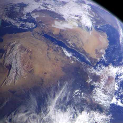 |
| Northeast Africa and the
Arabian Peninsula This image of northeast Africa and the Arabian Peninsula was taken from an altitude of about 500,000 kilometers (300,000 miles) by the Galileo spacecraft on December 9, 1992, as it left Earth en route to Jupiter. Visible are most of Egypt (left of center), including the Nile Valley; the Red Sea (slightly above center); Israel; Jordan, and the Arabian Peninsula. In the center, below the coastal cloud, is Khartoum, at the confluence of the Blue Nile and the White Nile. Somalia (lower right) is partly covered by clouds. (Courtesy NASA/JPL) |
Send mail to [email protected] with questions or comments
about this web site.
Copyright � 1998 Michael Ammar.
