![]()
| Home Michael Ammar Solar System Solar System Summary Sun Sun's Statistics Mercury Mercury's Statistics Venus Venus' Statistics Earth Earth's Statistics Mars Mars' Statistics Asteroid Field Asteroid Field's Statistics Jupiter Jupiter's Statistics Saturn Saturn's Statistics Uranus Uranus' Statistics Neptun Neptun's Statistics Pluto Pluto's Statistics Picture Library |
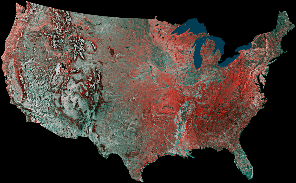 |
| USA This image is a mosaic of the United States prepared by using 16 images from the Advanced Very High Resolution Radiometer (AVHRR) sensors on the meteorological satellites NOAA-8 and NOAA-9. The images were acquired between May 24, 1984 and May 14, 1986. On false-color infrared mosaics, vegetation appears in various tones of red instead of green. The "redness" indicates vegetation density, type and whether growing on dry land or in a swamp (a mixture of reddish vegetation and dark blue surface water produces dark tones). Grasslands appear light red, deciduous trees and croplands appear red, and coniferous forests appear dark red or maroon. Desert areas appear white and urban areas (pavement and buildings) appear bluish green. Lakes, rivers and oceans appear in various shades of blue, dark blue for deep water and light blue for shallow or turbid water. Exposed bedrock generally appears as a dark bluish-green or other dark tone. (Courtesy USGS) |
Send mail to [email protected] with questions or comments
about this web site.
Copyright � 1998 Michael Ammar.
